Kolochava Nature Trail
-
Complexity
Difficult -
Length
15 km -
Duration
7 hours
-
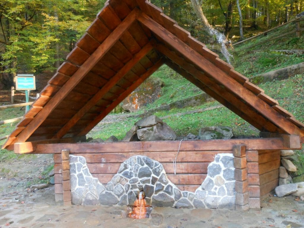
Mineral Spring

The route starts from the mineral spring known throughout the Tereblia Valley and beyond which is called “Burkut” by the locals.
Coordinates:
Google maps
-
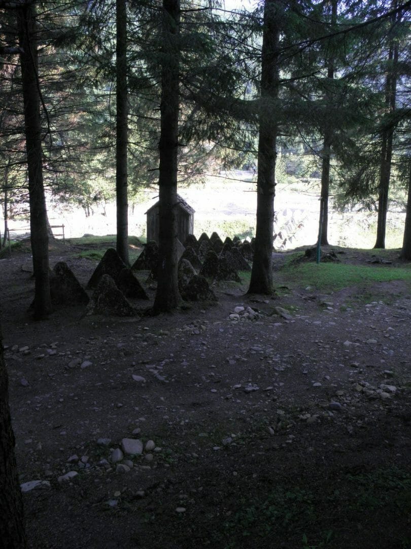
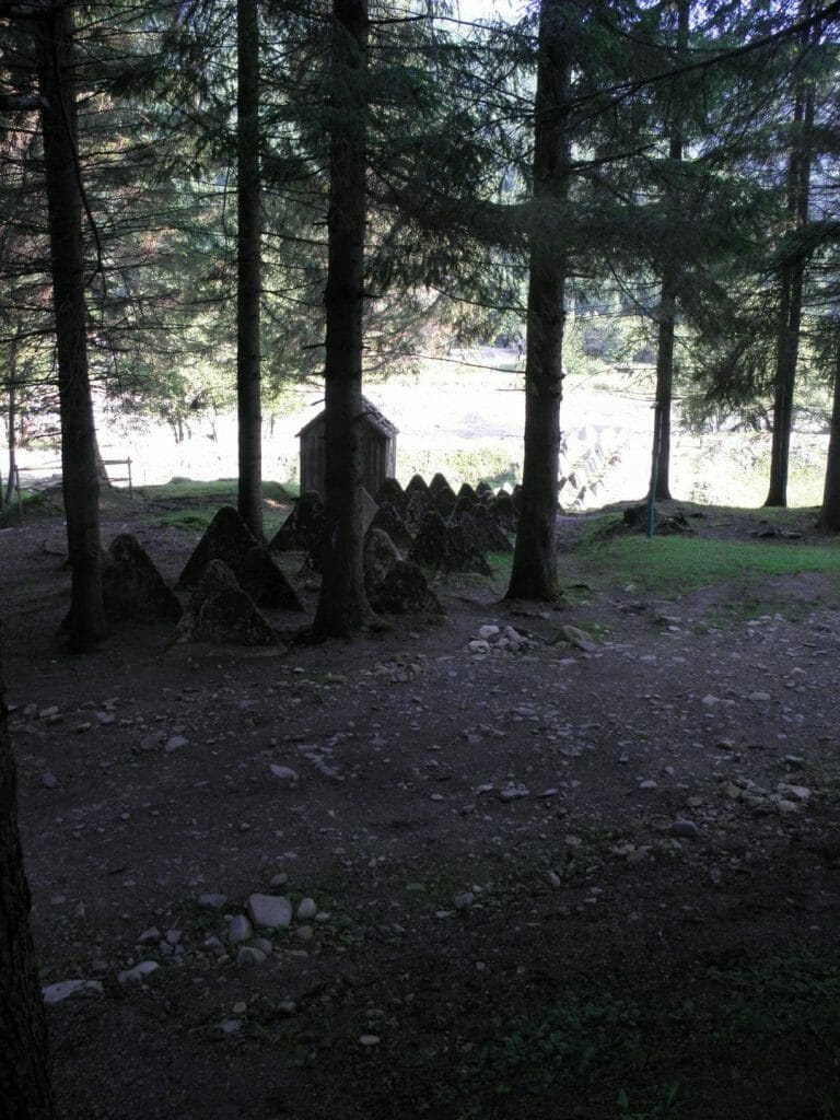
Arpad Line

Engineering constructions from World War II were made in the form of anti-tank reinforced concrete pyramids and other military fortifications. The remnants of the Arpad Line, which are scarcely drawn across the route of the trail, greet visitors menacingly, and recall the events of the last century, which are still alive in the memory.
Coordinates:
Google maps
-
Natural Source
Clean spring water, and a good place to stay for a while.
-
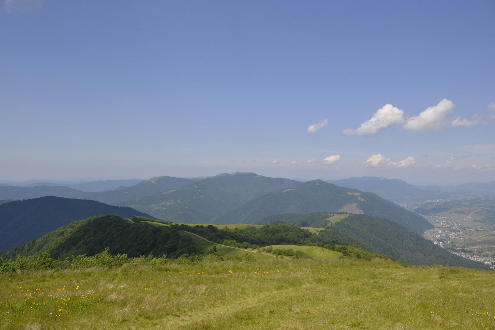
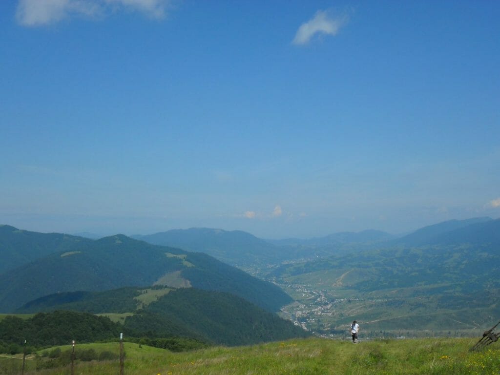
Kvasiv Verkh
Kvasiv Verkh mountain is one of Krasna mountain meadows’ peaks, where the television tower is placed. There is an unforgettable landscape of most of the houses in the Kolochava village and Tereblia Valley, as well as breathtaking views of the tops of Topas, Strymba, Kosyi Verkh and Tiapesh surrounding mountains.
Coordinates:
Google maps
-
Gas Transmission Line Tower

The top of Topas mountain is the highest peak of the route, from which, as in the palm of your hand, you can see not only Kolochava village and almost the entire Tereblia Valley, but also the majesty of the Carpathian Mountains, which stretch endlessly, hiding under the clouds.
Coordinates:
Google maps
-
Pryslip
A hollow between the mountains, which is at the same time the border of the territorial division of Mizhhiria and Tyachiv districts with beautiful landscapes and places for recreation.
Coordinates:
Google maps
-
Stav Tract
The final stop of the route, which is located in a residential area of Kolochava village. In case of bad weather, you can find a shelter in the house at the end of the route.
Coordinates:
Google maps


Deviation from the route.
Damage of natural objects.
Starting fires in places not designated for this purpose; smoking when passing through the forests.
Felling and damage of trees, plucking flowers, and collecting medical plants.
Hunting animals, and destruction of their habitats.
Any way of fishing.
Carry firearms.
Littering the territory; making noise.
Report to the Ministry of Emergencies before you go on a trip, so that rescuers can find you quickly, and in time if something happens. This requires only two steps:
-
Fill out the online form
Fill in the online form to inform the mountain search and rescue units about your planned trips to the mountains.
Online form -
Save the rescue units’ contacts
Put down the contacts of the mountain search and rescue units of the area in which you are going to travel to your mobile phone.
Units’ Contacts